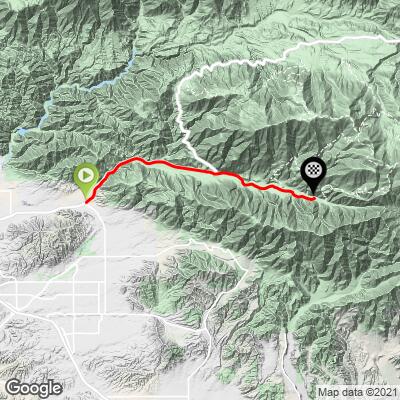
19.7
PDI
10.6 mi
DISTANCE
3,374 ft
GAINED
6 %
AVG. GRADE
FULL CLIMB STATS
INTRO
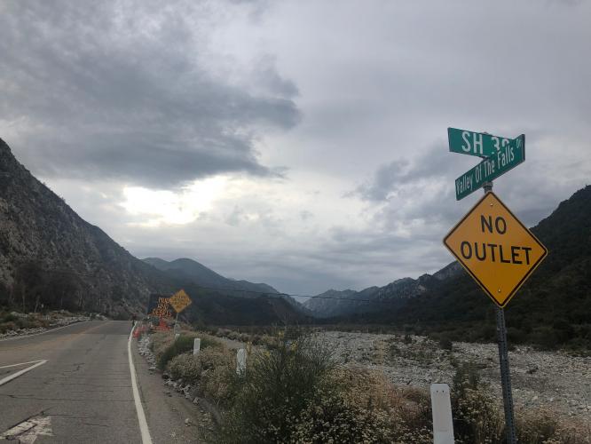
This climb begins very gradually and through a canyon on fairly busy Highway 38. At mile six veer right onto Valley of Falls Road for the final rural and rustic climb to the finish at Big Falls Trailhead.
PLAN YOUR ROUTE
6.2% average grade (6.5% climb only). 62% of the climb is in the 5-10% range and 5.6% is at 10-15%.
See more details and tools regarding this climb's grade via the “Profile Tool” button.
Roadway: The first six miles are on a state highway that is in good condition with a wide shoulder and rumble strips separating the traffic from bike lane.
Traffic: First six miles on the highway are moderate to busy. The last four miles on Valley of Falls Road traffic is mild.
Parking: There is a public parking lot at the Mill Creek Visitor Center - Map; Street View.
Provisions: There is a restaurant and store in Forest Falls at mile 9.2.
Before heading out on any cycling adventure check out our Things to Bring on a Cycling Trip and use our interactive check list to ensure you don't forget anything.
Use the “Routes in Area” button on the menu bar to see other bike climbs in this area.
ROUTE MAP
MEMBER RATING
CURRENT WEATHER
PJAMM TRIPS ADVENTURE STARTER BUNDLES
Check out PJAMM Adventure's prepackaged (self-guided) cycling trips. They will help you plan, document and conquer your next adventure.
NEARBY CLIMBS (0) RADIAL PROXIMITY
FROM No Climbs Found
MEMBER REVIEWS & COMMENTS
Let us know what you thought of this climb. Signup for our FREE membership to write a review or post a comment.
Already have an account?
LOG IN HERE
Brandon_O

Tough climb all uphill with one little downhill break but quite a few steep climbs.


